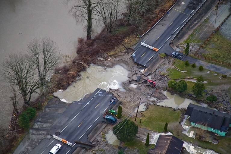
Anyone living in the Snoqualmie Valley in 2009 surely has a flood story.
Flows from the Snoqualmie River that January reached 60,000 cubic feet per second — 22,000 cubic feet over what’s required for a phase 4 flood alert. Evacuation orders were issued, roads were closed or destroyed, and some residents were airlifted to safety by helicopter.
River system floods, like the 2009 event, have historically been a focus of King County’s Flood Management Plan, a document that outlines how the county addresses and mitigates flood risks.
But as county officials prepare to update the flood plan for the first time in a decade, they are hoping to take a more holistic approach. This time around, they are putting a greater emphasis on climate change and less severe but increasingly frequent flood events.
King County’s Flood Management Plan is a strategic vision that identifies where flooding happens and narrows in on policies or projects that can address the risks they cause, said Jason Wilkinson, a project manager with King County’s Department of Natural Resources, who is leading the plan.
“It’s a super important document because it’s essentially how we plan to address flooding over the next ten years,” Wilkinson said.
The flood plan is receiving its first update since 2013, and its first comprehensive update since 2006, Wilkinson said. County officials will create the plan, taking feedback from stakeholders and residents of at-risk communities. A draft plan is expected to come near the end of the year.
The new plan will make several key changes. Notably, it is the first flood plan to explicitly address the impacts of climate change on flooding. The county has partnered with groups like the University of Washington’s Climate Impact Group to better understand what changes can be anticipated.
“We’re gaining a much better understanding of the potential implications of climate change,” Wilkinson said. “We have a real good opportunity before us to be able to take that updated information and apply it to the strategies that we use to address flooding.”
Additionally, the plan will target flooding beyond river-caused events, something that had also been neglected in prior plans. Urban, coastal and small tributary flooding, known for being low in severity but high in frequency, are all expected to become more common in the future.
“What we have seen is an increase in the frequency of lower severity floods that affect our day-to-day lives,” said Angela Donaldson, a flood insurance agent in Fall City and member of a committee working on the flood plan. “It’s not enough to warrant property damage, but it is enough to impact the crops for the farmers to close roads and have [State Route] 203 topping over.”
Donaldson said the most significant flood-related change for the Valley over the last decade has been an increased risk of landslides. With warm, dry summers and wildfires becoming more common, there is increased soil erosion, making it easier for flood waters to cause landslides or pull down trees.
“Because we’ve had such long dry summers, our trees and our plants are less resilient when we do get flooding,” Donaldson said.
Farms and their crops have been hit particularly hard by climate change, said Lauren Silver, executive director of the Snoqualmie Valley Preservation Alliance and another committee member.
Silver said the flood plan’s focus on climate change is “very relevant to us in the Valley,” due to drier summers coupled with more frequent flooding events, making it more difficult for farmers to produce crops.
While farmers anticipate flooding, she said, they have more frequently faced floods late into the season, sometimes into the early summer. Last year, there was a predicted flood event in early June, Silver said.
“Farming in a floodplain, you’re going to have floods during the flood season. And actually it really produces a great environment for agricultural production,” she said. “But over time, in the last couple of decades, we’ve been seeing more frequent and much more severe flooding events.”
Silver said the Snoqualmie Valley Preservation Alliance would like to see the new flood plan better focus on strategies specific to mitigate tributary flooding in the Valley as well as differentiate management strategies for rural areas vs. urban ones, making it easier for farmers to implement small mitigation projects. She also hopes the county will evaluate water storage strategies as the demand for water increases.
“It’s nice to be at every one of these meetings and bringing issues and challenges to decision makers,” she said. “Hopefully it will lead to the prioritization and allocation of funding and support to implement actions that will alleviate these issues in the future.”
Check it out:
Through June, King County is running an online survey for residents to share their ideas on flood resiliency. The survey is one step in the development of the Flood Management Plan. Take the survey at bit.ly/3LvzDQC.


